One vehicle, a couple of days, two of America’s four National Lake Shores, an endless amount of spectacularly beautiful sights and relatively few visitors. That’s what you’re in for during this remote island escape.
This summer, take a short road trip in the northern U.S. to Apostle Islands National Lakeshore, Wisconsin and Pictured Rocks National Lakeshore, Michigan, located along the southern shore of Lake Superior. Both the Apostle Islands and Pictured Rocks are stunning lake destinations where hiking, biking, fishing, camping and sailing are the order of the day. Simply put, both spots and the 250 miles of road-less-traveled that connects them have a magical allure that can shape a short summer break that has long-lasting benefits and memories.
The Road Ahead
With irresistible temptations like crystalline, teal-colored water (Lake Superior can look like the Caribbean), sandy shores, red sandstone caves, old-growth forests and cute towns, this trip is a visual feast.
Total Distance: 250 miles
Time Driving for Direct Route: 4 hr., 32 mins.
Suggested Trip Duration: 2 days (or more, if you want to linger)
Route: Start your road trip in Bayfield, Wisconsin (located in the far north of Wisconsin) taking M-28 E, tour the Apostle Islands National Lakeshore, continue eastward to Munising, Minnesota to tour Pictured Rocks National Lakeshore.

Day 1: Bayfield, Wisconsin
Bayfield, the gateway to the Apostle Islands and home to 487 people, is the embodiment of small-town America and oozes charm (of the Hallmark movie ilk) — through quaint and artistic shops and galleries, inns, coffee shops and restaurants. Its various accolades and titles clue you in to the magnitude of its cuteness: It was named a USA Today Best Coastal Small Town, is Wisconsin’s Smallest City and is the Berry Capital of the State.
Grab a coffee and pastry at homey Wonderstate Coffee, then explore the town’s active art scene and downtown shops and watch sailboats glide on the lake. Afterwards, drive around the local countryside to visit orchards and fruit farms — the rolling hills are known for producing some of the largest crops of apples, blueberries and strawberries in the Midwest. Pick your own fruit or pick up jellies, jams, preserves and other goods at the farm stores on Bayfield’s Fruit Loop. Speaking of delicious foods, you may also want to sample the local lake catches of the day in town — especially the whitefish, which the local restaurants serve every which way. Manypenny Bistro garners rave reviews for their white fish tacos and pizzas.
While you could certainly linger and explore along the lakeshore right here, the Apostle Islands, a chain of 22 islands extending northward and eastward from the Bayfield peninsula into Lake Superior, beckon.
Drive times to Bayfield from area cities: Minneapolis, MN (3 hrs. 50 mins.); Madison, WI (5hrs. 30 mins.); Milwaukee, WI (6 hrs. 20 mins.); Chicago, IL (7 hrs. 30 mins.)
The Apostle Islands National Lakeshore
From Bayfield, travel north for about 18 miles on State Hwy. 13 to Meyers Road.
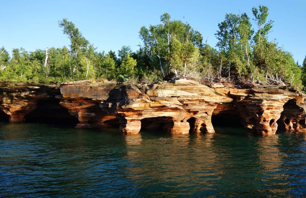
The Apostle Islands National Lakeshore in Wisconsin, which encompasses 21 of the 22 Apostle Islands, is celebrating its 50th anniversary from 2020 through 2021. And there’s lots here to celebrate — from its beautiful singing sand beaches, sea stacks and sandstone caves to its eight lighthouses (the area is home to the largest collection of lighthouses in the U.S.), abandoned quarries and mind-blowing overlooks.
Mainland Sites: Sea Caves and More
You can experience many of the Apostle Islands National Lakeshore’s most wonderful features right on the 12-mile mainland section, but you may also want to venture out onto the waters and experience some of the islands, too.
The mainland incorporates the most visited and photographed sea caves in the Apostle Islands. Hike the moderately difficult Lakeshore Trail to get sweeping views of these breathtaking wonders from above as well as hardwood forests. The starting point is at the Meyers Beach parking lot.
Exploring the Remote Islands
If you do want to explore the more remote islands during your visit (which are over 20 miles away from the mainland), you can take a sightseeing, narrated cruise with The Apostle Islands Cruise Service; charter a sailboat; hop on a ferry or water taxi (several times a day, Madeline Island Ferry heads out to Madeline Island — the biggest Apostle Island and the only one that’s not in the Apostle Islands National Lakeshore); or kayak on your own or on a guided trip with a trained outfitter. In a kayak, you’ll get an up-close-and-personal view of the sea caves, stone cathedrals and crevices.

More Popular Islands to Explore:
Devils Island’s dramatic rock formations and sea caves are particularly popular with kayakers, who can paddle in and out of the caves on calm days. Visitors also enjoy climbing the Devil’s Island Light tower at the island’s northern end and seeing the original keeper’s quarters. Many trails also snake around this island.
Michigan Island boasts the Michigan Island Light, which has two towers and a new museum. Apostle Island Cruise Service offers Michigan Island Lighthouse tours from June to September.
Stockton Island, the largest island in the National Lakeshore, is famous for its large population of black bears and the singing sand in Julian Bay. Numerous trails make it easy to explore and experience the island’s special character.
Raspberry Island features the Raspberry Island Light, and Sand Island is home to the Sand Island Light. Apostle Island Cruise Service offers a Sea Caves & Lighthouse Tour that visits sea caves as well as both lighthouses.
Take M-28 to Munising and Pictured Rocks National Lakeshore
Day 2: Munising
Munising, located in Michigan’s Upper Peninsula Munising, Minnesota is the gateway for Pictured Rocks National Lakeshore. For a town of just 2000 people, it has so much to offer: restaurants and cafes, and exquisite shorelines, waterfalls, and historic lighthouses nearby.
Start your day off at Falling Rock Cafe & Bookstore for a morning dose of caffeine, breakfast and maybe some quiet reading time (they stock books written by local authors). The fuel will come in handy as you set about exploring some of the wild nature at Pictured Rocks.

Pictured Rocks National Lakeshore
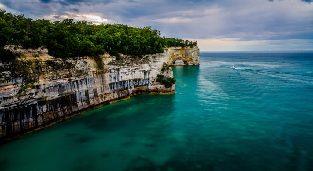
Plan on dedicating most of your day to exploring the legendary 200-foot-tall, mineral-streaked cliffs of Pictured Rocks National Lakeshore (the first lakeshore to be designated a National Lakeshore in the U.S.). Some of the other magnificent features you’ll see: sand dunes, waterfalls, inland lakes, forests and 100 miles of scenic hiking and biking trails.
The 15 miles of jaw-dropping sculptural sandstone rock formations, known as the Pictured Rocks Cliffs, are every bit as beautiful (think: red, orange, blue, green, brown, black and white streaks) as those in the western U.S.’ more famous national parks. And the water along the white-sand Lake Superior beaches near Castle Rock and Miners Castle is so clear and turquoise, it’ll have you thinking you’re in the South Pacific.
Take a Cruise or Paddle on Lake Superior
Consider taking a 2.5-3 hour-long cruise along the most stunning 40 miles of the lake’s shoreline (Lake Superior is so huge, it’ll feed the illusion that you’re cruising on ocean waters) with Pictured Rocks Cruises, located right at the Munising City Dock. Getting out on the water will give you the distance you need to really take in the rock formation’s awesome shapes and colors. The company also offers a kayak tour (2 hours of paddling is involved) that starts at the point where the best scenery begins.

5 Top Spots to See in Pictured Rocks National Shoreline
In addition to the Pictured Rocks Cliffs, you’ll see many of the below hot spots during a cruise, but you can also access some of them by foot and/or vehicle.
Grand Portal Point, the highest point along the park’s sandstone shoreline, offers one of the best views in the park — from the water, expect to see a number of caverns, a huge rock face, a suspended archway and incredible, soaring rock formations. If you want to see Grand Portal Point by hiking, explore the Chapel Basin/Mosquito Area (2-10 miles roundtrip, depending which trails you decide to follow).
You have to view Spray Falls, located 2 miles northeast of Chapel Beach, from the water as there’s no trail access. The falls careen about 70 feet over the cliffs into Lake Superior toward an 1856 shipwreck stuck at the base.
Near Spray Falls, Twelvemile Beach beckons with the kind of beauty that makes you gasp. And if you decide to stay one more night and camp at its 37-site campground, the stargazing will blow you away. If you can’t camp, at least consider staying for the spectacular sunset views. You can access the beach via stairs from the tall bluff at the campground day-use picnic and parking area.
Miners Castle, the most famous rock formation in the park and the only cliff area accessible by vehicle, sports turret-like features resembling those of a castle (in 2006, one of those turrets tumbled into Lake Superior). You can see Miners Castle from three separate viewing platforms (the two upper ones are wheelchair accessible), all a short walk from the parking lot. Just wait ‘til you see the color of the water below!
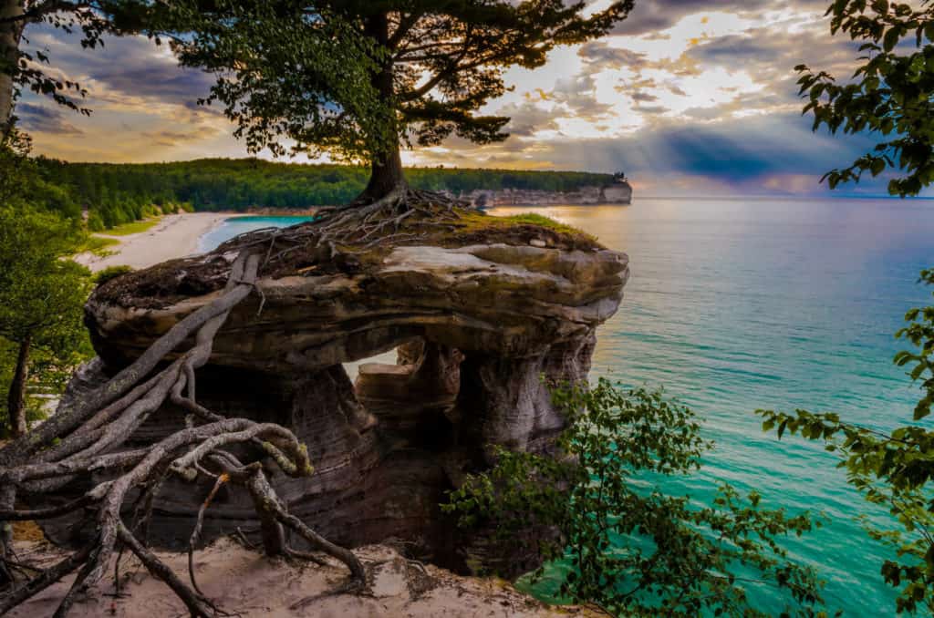
Chapel Rock, an iconic rock formation that juts up from Lake Superior near the shoreline, is a solitary stack of sandstone, topped by a single white pine tree thought to be around 250 years old. The natural structure is so beautiful, it inspired the U.S. Mint to picture it on a 2018 quarter release as part of the America the Beautiful Quarter Program. A cruise is the best way to view Chapel Rock but if you want to see it on foot, you’ll have to take a 6.2-mile roundtrip hike (from the Chapel/Mosquito trailhead parking lot).
