Though there’s plenty to do in the sunny city of Tucson, the surrounding area is also filled with a plethora of exciting places to visit. The best way to explore this lovely region is to head out to the highway and explore; from awe-inspiring natural beauty to unique Wild West landmarks, it’s definitely worth venturing out to Southeastern Arizona via Interstate 10 to catch some of the state’s best sights.
The following itinerary follows a loop from Tucson, heading Southeast from Interstate 10. There are several stops along the way, with the final stop located in Sierra Vista. After Sierra Vista, travelers have an easy trip back to Tucson via AZ-90 and I-10 west (approximately 1 hour, 15 minutes). This could easily be a day trip—however, those with more time may want to stretch it into multiple days, as there are plenty of accommodations (including campsites), along the way. The beauty of this trip is that it is customizable, and can be adapted depending on how much time is available.
Tucson to Sierra Vista
Total Distance: 75.7 miles
Total Travel Time Without Stops:1 hour, 15 minutes
Total Stops: 5
About This Trip
Most of this trip winds its way through the Coronado National Forest, a 1.78 million acre forest that is spread throughout various mountain ranges; not only in Arizona but also in New Mexico. Divided into five ranger districts, each consisting of multiple sky island mountain ranges. Because these sky islands are a mix of large mountain peaks (some up to 6,000ft. tall) combined with distinct lowland areas, they are known for their incredible biodiversity in both plant and animal life—making Coronado National Forest an area known for its vast, natural beauty and often quixotic landscapes. The Chiricahua National Monument is one of the most well-known sky islands in Southeastern Arizona and is worth a visit if only for the stargazing—it was recently designated the 104th International Dark Sky Park in the world.
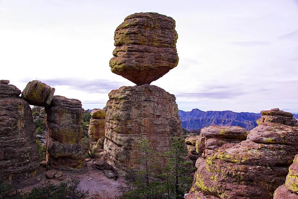
However, the Coronado National Forest is not only known for its diverse landscapes and wildlife; it is also known for its history. For example, located in the Dragoon Mountains within the Forest is the Cochise Stronghold—a lovely, secluded woodland area surrounded by rough granite and sharp cliffs rising above the landscape at an impressive 5,000 feet. Named because it served as a refuge for Cochise, the famed Apache chief, and his people during conflicts with the U.S. Army in the 1850s and 1860s, the area is recognized as one of the most historic sites in Arizona. Located to the west of Sunsites, Arizona, the site is easily accessible via this itinerary by continuing west on I-10 from Benson before continuing on to Tombstone.
The First Stop: Benson, AZ
Total Distance (non-stop): 46 miles
Total Drive Time: 47 minutes
Route: Take I-10 East from Tucson, then HWY 80 into Benson
Benson is a picturesque, charming town known as the Gateway to Cochise County—steeped in history, its Old West culture and Railroad heritage make it an ideal first stop to begin a journey into the historic area of Southeastern Arizona.
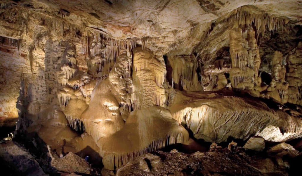
Visit the Train Depot to learn more about the town’s Railroad history, then head to Kartchner Caverns State Park to soak in some of the area’s natural beauty. Located just south of Benson on State Highway 90, Kartchner Caverns State Park is located in the foothills of the Whetstone Mountains. The park is over 550-acres and is the perfect spot for hiking, picnicking, and touring the namesake caverns. There are also campsites and cabins located within the park for those who want to spend the night.
Camp at Kartchner Caverns State Park
Side Trip: Dragoon
Total Distance (non-stop): 17.7 miles
Total Drive Time: 22 minutes
Route: I-10 East from Benson
Rising majestically on the Arizona landscape between Wilcox and Benson are the Dragoon Mountains. Historically significant due to their position within the Cochise Stronghold, these jagged peaks offer an interesting glimpse into the area’s Native American history. A relatively small mountain range, the Dragoon Mountains are rocky and virtually impassable at their highest elevations, while the lower slopes support trees, grasses, and other desert plant life. The most significant part of the Dragoons is their importance to the famous Chiricahua Apache leader Cochise and his people, who used the canyons, caves, and serpentine trails as a refuge from colonial invaders.
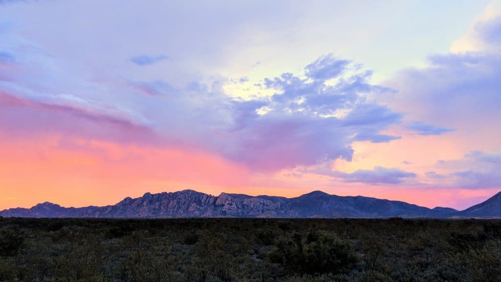
The Dragoon Mountains offer more than just history—they are also the perfect place for outdoor enthusiasts to hike and explore. Mt. Glenn is the highest point of the mountains that consist of a series of jagged, rugged cliffs and serpentine trails that served as hideouts for the Chiricahua Apache Indians during their skirmishes with U.S. forces. Rising up out of the rocky formations is the gentle giant Mt. Glenn—itself tame in comparison to the surrounding landscape, yet no less impressive. An open, relatively easy, and scenic cross-country trek awaits visitors to this grassy mount nestled amongst the Dragoon Mountain Range.
Today, there is a Forest Service campground in the western canyon. It has a 0.4 mile self-guided loop trail that wanders through the desert landscape, providing an introduction to a number of desert plants as well as some of the principles of the desert ecology. A hiking and equestrian trail from the campground follows Cochise’s old escape route across the mountain range.
A great stop to learn about the area’s influential Native American influence and history, the Amerind Museum has been a curator of cultural objects; historical artifacts; and collected histories of America’s native peoples. Open since 1937, the museum has been dedicated to preserving these important histories through artifacts, education, and community outreach. From the storied past to the rich, contemporary heritage of Native Americans throughout the Southwest, visitors will enjoy this “cultural hub for southern Arizona.
A designated historic site in Cochise, Dragoon Springs Stage Coach Stop is a must-see for history buffs and for anyone looking to get an authentic Southwest experience. While only ruins remain at the site of the old stagecoach stop, the site was the home of many a battle between soldiers and native Apaches, the ruins were also an important site for mail companies who used the route throughout Arizona. Located at the Northwest corner of the Dragoon Mountains, the area offers a taste of Wild West history along with some spectacular views of the area.
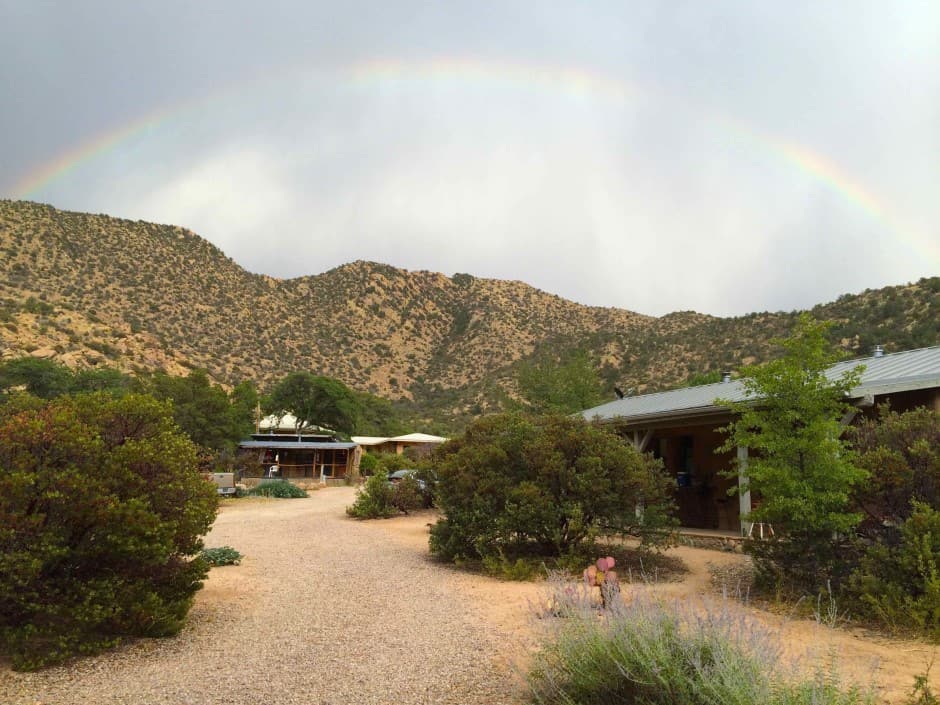
Also located in the Dragoon Mountains is the Dharama Treasure Buddhist Sangha. Here, visitors can book a woodland retreat located in the lovely landscape, towering peaks, and lush evergreen and oak forests of the Cochise Stronghold. Surrounded by hiking and horse trails, visitors can explore the area and soak in the relaxing atmosphere of this natural wonder and meditative retreat.
The Second Stop: Bisbee via Tombstone
Total Distance (non-stop): 24 miles
Total Drive Time: 36 minutes
Route: Take HWY 80 South
Tombstone is a great place to experience the spirit of the Old West at its finest. Walk in the footsteps of Wyatt Earp and Doc Holliday, see the infamous O.K. Corral, and visit one of the town’s many saloons, restaurants, and shops—all while learning about the fascinating history of this former Wild West boomtown.
Side Trip: Slavin Gulch
Located Northeast of Tombstone is the Savin Gulch Trail. Situated deep in the Dragoon Mountains, it’s extremely secluded and is accessible via Middlemarch Road (one mile North of Tombstone). At the Forest Boundary, turn left onto FR 687; then right onto FR 687A. A four-wheel drive is recommended for the trip, as it is a rough road. The trail begins at the end of the road, and is worth checking out for the scenery—including nearby Tombstone, the Huachuca Mountains, and Slavin Gulch. It is also a great place to encounter desert wildlife.
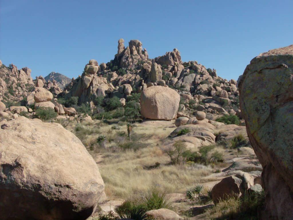
Also nearby and beginning on Middlemarch Road is the scenic drive to Council Rocks. Historically known as the place where Cochise signed the Broken Arrow Peace Treaty in 1872, the road parallels the Dragoon Mountains and is incredibly scenic—rocky spires; shallow caves; and lovely savannah dotted with desert flora are just some of the sights visitors can encounter on this mountain road. Turn east on Forest Road 687K to access the parking area, and hike on the short, steep trail to explore the foothills and caves.
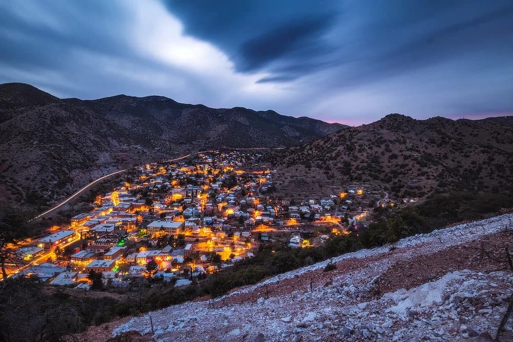
Continue on HWY 80 to Bisbee, less than a half-hour from Tombstone. Nestled among the Mule Mountains, Bisbee is the county seat of Cochise County; and its meticulously preserved early 20th-century downtown will charm visitors with an appreciation for history and architecture. This “Sky Islands” town is also a great place to find must-see attractions such as Bisbee’s Heritage Stairs; the Bisbee Mining & Historic Museum; or even take in an Old Bisbee Ghost Tour. There are plenty of accommodations for those wishing to spend the night and enjoy one of Bisbee’s diverse restaurant offerings.
The Third Stop: Miracle Valley
Total Distance (non-stop): 21.2 miles
Total Drive Time: 26 minutes
Route: AZ-92 West from Bisbee
Miracle Valley is an overgrown ghost town on the way to Sierra Vista that is worth checking out to take a tour of the once-thriving religious community. Following the famous “Miracle Valley Shootout” in the early 1980s, the settlement was abandoned for good and has fallen further into run—making it a true ghost town. Currently, efforts are underway to raise money for its restoration.
The Final Stop: Sierra Vista
Total Distance (non-stop): 17.4 miles
Total Drive Time: 24 minutes
Route: Continue on AZ-92 West from Miracle Valley
Sierra Vista is known as a year-round destination with over 270 days of sunshine per year—making it an ideal spot to enjoy outdoor adventures; sunny skies; and wide-open spaces that boast some of the prettiest scenery around.
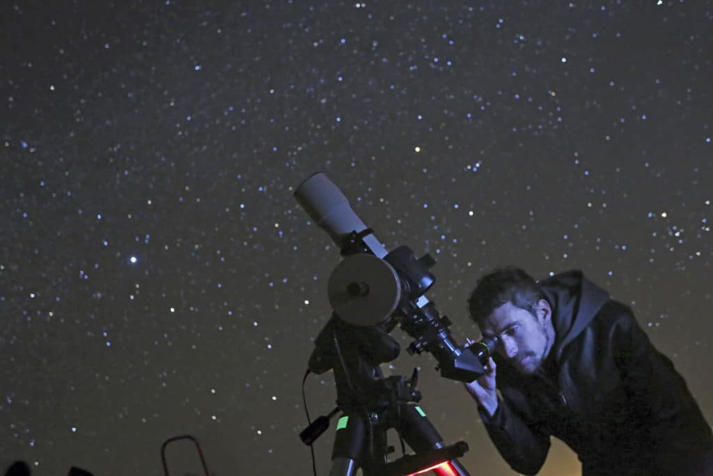
There are outdoor adventures a-plenty in Sierra Vista—with numerous opportunities for hiking, biking, horseback riding, wildlife watching, and more. Coronado Cave is also worth exploring, both for its scenery and history. Take the one-mile-round trip hike from the Coronado National Memorial Visitor Center to explore the 600-foot long cave—rumored to be a former hideout of Geronimo. Sierra Vista is also known for its incredible stargazing opportunities. Rent an astronomy discovery pack from the Sierra Vista Public Library, or head up to the Patterson Observatory to view the skies through their 20-inch telescope. Want to view the skies in comfort? Then stay at one of Sierra Vista’s many RV and Camping sites to sleep under the stars.
Sierra Vista is also home to plenty of historic sites like Fort Huachuca. Known as the “Home of the Buffalo Soldiers,” the site is where the U.S. Army headquartered while waging famous campaigns against the likes of the Chiricahua Apaches and their famous leader Geronimo. Also home to the Old Post Cemetery and the Reservoir Hill Overlook, this National Historic Landmark has its own historic district with many notable late 19th century buildings. The area is also known for its Old West heritage, which includes the turn of the 20th century Brown Canyon Ranch; many Native American sites (including the Cochise Stronghold); and several nearby ghost towns. For those in no hurry to return to Tucson, Sierra Vista has a number of accommodations (outside of their RV and campsites).

Watch next: Venturing Out Park 2 Park Tucson Ropes and Fears
Read next: Tucson: An Oasis in The Sonoran Desert
