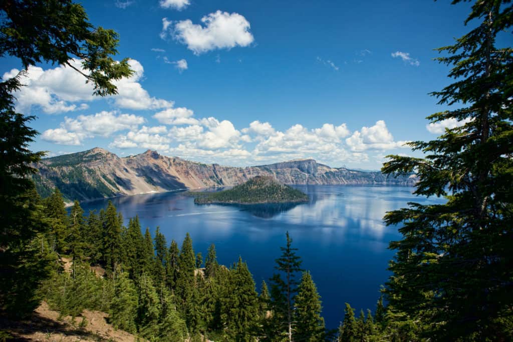
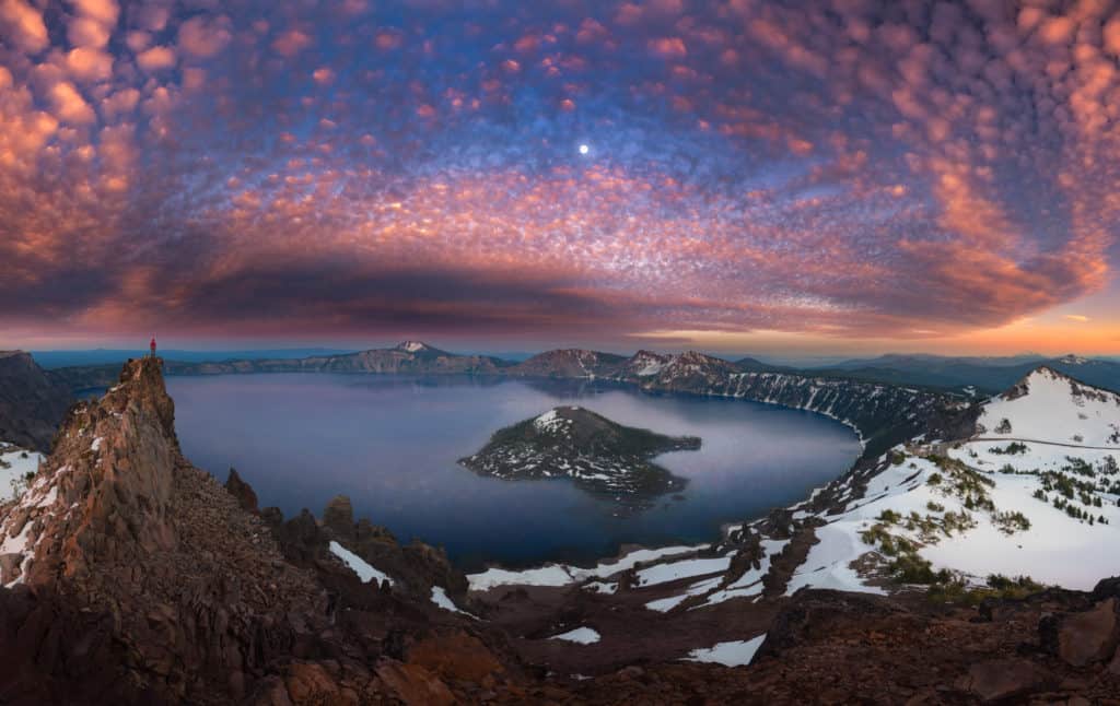
Every summer, from late June through mid-September, the snow that blankets Crater Lake National Park (about 533 inches per year), disappears to reveal details of a majestic volcano-carved landscape located about 7,000 feet up in the Cascade Mountains of southern Oregon. Drive in and around the park during this short season of glory and you’ll be greeted by sights that are guaranteed to take your breath away. The main feature of this spectacular terrain: a bluer-than-blue circular lake encased within the mouth of a collapsed dormant volcano. At 1,949 feet deep, this lake is the deepest in the U.S. and, according to many scientists, the cleanest and clearest large body lake in the world.
As the skies clear and the park roads gradually open, various trails do too, and visitors begin hiking to take in the stunning rock and water views, and experience the old-growth forests that pepper the park landscape — towering ponderosa pines, ancient whitebark pines and 13 other species of conifers. But the most popular way to take in the park’s scenery is by car along the scenic 33-mile-long Rim Drive. It’s only open in summer and traces the edge of the volcanic crater, starting at 6,500 feet above sea level and rising to 7,900 feet at the highest point. The route, which takes about two hours to complete (including eight or more stops), will not only let you ogle the lake from every angle but also the surrounding peaks and Wizard Island, a dramatic cinder cone that pokes up from the depths of the water.

There are 30 different overlooks on Rim Drive (eight of which are considered the main observation points and include roadside parking; the others have pull outs along the road). The road is listed as a historic district on the National Register of Historic Places because of its unique construction and the special park environment it passes through.
The vista from each of the overlooks is a photographer’s dream — they offer up various views of the lake, important geological features of the caldera and distinctive types of environment, for example, meadows.
Tip: Arrive at the park before 9 am or after 4 pm to avoid the lines at the entrance points and congested parking areas.
Where to Access the Rim Road
There are two access points to the Rim Drive loop: the South Entrance, which begins at the Crater Lake National Park headquarters in the Munson Valley Historic District, and the North Entrance, located nine miles north of the Rim Drive junction across from Pumice Desert — a dry meadow with few plants and a pumice base. Like the Rim Drive itself, the North Entrance Road is only open in summer.
The Rim Drive Route and What You’ll See Along the Way
If you enter at the southern access point and head northwest from the Crater Lake National Park headquarters at Munson Valley, you’ll be taking the West Rim Drive, which is the direct route between the park’s North and South entrances.
Rim Village/Sinnott Memorial Overlook
Stop by the Rim Visitor Center inside the historic Kiser Studio in Rim Village (7 miles north of highway 62 or 14 miles from the North Entrance) to access prominent views of the lake. This center is only open in the summer — be sure to ask questions and pick up a relief map depicting standout features of the lake.
Nearby, the Sinnott Memorial Overlook, a small stone natural history museum built into the caldera cliff above the lake, showcases geological exhibits about the formation of Crater Lake, and rangers offer short talks on a variety of topics.
This webcam captures views of the lake looking northward from the Sinnott Overlook. On clear days, you’ll be able to see Wizard Island; Llao Rock, a rock pillar that rises 8,049 feet above the water on the northwestern side of the crater rim; and Mount Thielson, a majestic horn-shaped peak with a distinctive spire that rises up from the landscape just north of the lake.

Travel 1 mile from the Sinnot Memorial Overlook to reach the Discovery Point viewing area. The name of this overlook indicates the fact that it’s the spot where, in 1853, the enormous caldera (large volcanic crater) and lake were first discovered.
From here, heading northward, you’ll travel 5 miles to the North Entrance Road Junction. Other places to stop: The Watchman and Merriam Point — each offers a wonderful view. Just past the junction, you’ll traverse the rear side of Llao Rock and start driving the East Rim Drive portion of the route, which is less crowded than the West Rim section.
If you feel like taking a challenging hike, there’s a trailhead for the only trail that leads down to the crater at Cleetwood Cove, located 4.6 miles from the North Entrance Road Junction. Though it’s only 1.1 miles long, the Cleetwood Cove Trail drops 700 feet with a series of switchbacks, making it a steep and arduous hike, especially on the return ascent. You can wade and swim in the lake within 100 yards of Cleetwood Cove if you can handle the trail and the chilly water temperature (57 degrees on average). The park service also maintains a marina for boat tours at Cleetwood Cove, but the tours do not run consistently. Check on boat tour availability here — when operational, one tour goes out to Wizard Island, where you can hike up the Wizard Island Summit Trail to the 90-foot-deep crater at the summit.
Past Cleetwood Cove, there are several pullout vista points, which, for the most part, are bordered in the road’s original stone masonry. Consider stopping just above Grotto Cove and at Skell Head, Cloudcap Overlook, Sentinel Rock and Kerr Notch. They all provide wonderful views of the lake and Mount Scott, which is 8,929 feet tall — the highest point in the park.
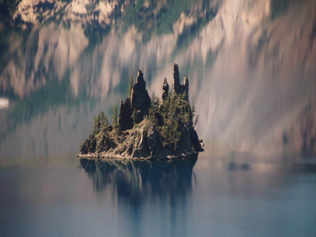
After Kerr Notch, Rim Drive stops providing views of the lake; it cuts across the east face of Dutton Ridge offering views of the Klamath Basin and its steep scarp frame, and then proceeds to descend to the Sun Notch trailhead. This short hiking trail from here will take you through a grassy meadow with flowers and Hemlock and along the rim of the caldera, where you’ll get spectacular views of the lake and Phantom Ship — another island in the lake that is covered in stony ‘masts’ formed about 400,000 years ago.
The drive continues to a parking area in front of Vidae Falls— 115-ft. cascade over a three-stepped bluff just steps from the road. On the final 2 miles of Rim Drive, you’ll pass by Castle Crest Wildflower Garden, located just south of the park headquarters. Take the ½-mile Castle Crest Nature Trail through the wetland wildflower meadow (peak bloom is in July and August.) The Rim Road ends a half mile from Castle Crest parking area, near the park headquarters and visitor center.

Park Entrance Fees in Summer
The park is open 24 hours a day and charges $30 per private passenger vehicle. Given the popularity of the park in summer, it’s best to purchase a pass online ahead of your trip. Check out non-car entrance fees here. Traffic flows in both directions on Rim Drive, which is narrow, tightly curving and has no shoulders. The speed limit is 35 mph and bicyclists also take this road, so drive with caution!
Places to Stay Before & After Your Rim Drive Road Trip
If you’re seeking to stay overnight in or near the park, refer to this page for a list of hotels and campgrounds located with 35 miles of Crater Lake National Park headquarters.
Read next: Day Trip to Magical Block Island off the Coast of Rhode Island – Block Island is one of 12 “Last Great Places” in the western hemisphere and it’s a place best explored without your car.

